


Placemaking projects can be big or small but no matter what their size the ones that I think make the biggest difference to the community is how they transform an unused, unsafe, unwelcoming space into a vibrant, fun, safe place for the community to gather.
So I found of interest an article by Jessica Leber called What Could We Do With The Space Below New York's 700 Miles Of Elevated Roads And Trains? The byline says it all: There is vast potential in the urban spaces we tend to ignore.
What space is more unused, unsafe and unwelcoming than underneath our cities’ elevated bridges, highways, subway and rail lines – and in some places even the rail lines themselves.

The article refers to a recent report, Under the Elevated: Reclaiming Space, Connecting Communities,presented by the Design Trust for Public Space and the New York City Department of Transportation. The report presents an in-depth plan to reclaim and transform these public spaces, referred to as “el spaces” and details why this massive inventory of residual space must be reimagined. Under the Elevated “envisions how to increase the vibrancy and resiliency of not only the neighborhoods in all five New York boroughs, but also in cities everywhere, by addressing and reclaiming the spaces associated with elevated transportation infrastructure.”
The report estimates there are 7,000 miles of space under elevated structures across the U.S. In New York City alone there nearly 700 miles of elevated infrastructure taking up an area nearly four times the size of Central Park. Under the Elevated is the first major urban initiative to propose a comprehensive approach in dealing with these spaces citywide.
Ms. Leber points out that some of these spaces are already drawing the attention and inspiration of some folks. “The 168 miles of elevated train tracks alone (mostly in Brooklyn, Queens, and the Bronx) cast light in fascinating patterns, inspiring the work of artists and poets. The stunning arches beneath the Manhattan Bridge help make the DUMBO neighborhood the creative hub it is today. Skateboarders thrive under many of these structures, and directors film iconic car chase scenes that make movie history.”

With the release of Under the Elevated, the Design Trust for Public Space, which jumpstarted interest in the High Line, a public park built on a historic freight rail line elevated above the streets on Manhattan’s West Side with a 2002 report, hopes to do the same for these types of spaces beneath road and rail infrastructure across the city.
The High Line gave new hope to abandoned elevated structures across the United States. It has become so popular that many cities want to build something like it. Untapped Cities describes ten plans for elevated parks around the World including Helsinki’s Baana Bike Corridor was built onto a century-old freight railway gorge and the West Toronto Railpath which turned a railway into a multi-use trail containing public art installations, native plants, and plazas.

The Bloomingdale Trail and Park will be a multi-use linear park that will be the first of its kind in Chicago. The trail and park will run along an unused, elevated rail line stretching 2.7 miles through four vibrant Chicago northwest side neighborhoods. The conversion of the elevated Bloomingdale Line into a trail and park provides unprecedented connections to and among these communities.

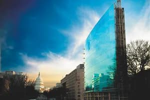
And in Washington, DC, plans are underway to build the 11th Street Bridge Park, DC’s first elevated park over the Anacostia River. The project focuses on erecting a public gathering space atop piers that held up the old 11th Street Bridge before it was replaced. Jason Long, a partner at the Office for Metropolitan Architecture said the project offers D.C. a chance to take advantage of the abandoned bones of old transportation routes and use them to create parks, walkways and other civic spaces.

Is there an “el space” in your community that has the potential to become a welcoming, safe, vibrant public space and destination?